 |
| 結婚10周年アートの旅 2023年2月6-12日 このセクションは主に、鎌倉- 岡山間の移動についてです。 10th Wedding Anniversary Art Trip, 6th of February 6th -12th of February 2023 This section is mainly about travel between Kamakura and Okayama. |
目次 / Contents
1) "結婚10周年アートの旅" / "10th Wedding Anniversary Art Trip"
2) 鎌倉- 品川 / Kamakura -Shinagawa
3) 品川 - 岡山 / Shinagawa - Okayama
A. 東海道・山陽新幹線 / Tokaido-Sanyō Shinkansen
B. 富士14景 / 14 Views of Mt. Fuji
C. 歌:"ふじの山" / Song : "Fuji no Yama"
D. 活火山 / Active Volcano
E. ジグザク / Zigzag
a) 'ブルドーザーが登る道' について
About the 'Bulldozer Climbing Road'
b) '森林限界'について
About the 'Bulldozer Climbing Road'
F. 浜名湖 / Lake Hamana
G. 伊吹山 / Mount. Ibuki
1) "結婚10周年アートの旅"
"10th Wedding Anniversary Art Trip"
2月14日が私達の結婚記念日で、今年、10周年を迎えます。
"結婚10周年アートの旅" をしました。
ずいぶん前に、ある本で、直島 (ナオシマ) の
豊島美術館 (テシマビジュツカン) を知り、行きたいと思っていました。
また、夫Rが四国へ行ったことがなかったので、四国のアートを巡る旅にしようと計画を始めました。
ですが、四国でのアート関係を追うと、香川県中心になり、結局、
香川県内での移動になりました。
直島も豊島も香川県です。
香川県でのアートの旅を終えた後、彼女に会いに、淡路島もこの旅行に入れました。
 |
| 直島・ベネッセホテルにて At Benesse Hotel, Naoshima Island |
"10th Wedding Anniversary Art Trip"
14th of February is our wedding anniversary, and this year marks our 10th anniversary.
We had our "10th wedding anniversary art trip".
A long time ago, I found about the Chichu Art Museum in Naoshima Island and the Teshima Art Museum in Teshima Island in a book, and I wanted to go there.
Also, my husband R had never been to Shikoku, so I started planning a trip to see the art in Shikoku.
According to Wiki about Shikoku,
"Shikoku ('four provinces') is the smallest of the four main islands of Japan."
However, as we pursued art in Shikoku, we ended up focusing on Kagawa Prefecture, and we ended up traveling within Kagawa Prefecture.
Both Naoshima Island and Teshima island are in Kagawa Prefecture.
My friend M changed her work and is now working on Awaji Island, Hyogo Prefecture.
After finishing the art trip in Kagawa Prefecture, we included Awaji Island in the trip to see her.
 |
| 赤い部分 : 四国 Red Part : Location of Shikoku in Japan 画像は下記より / This from below ★ |
 |
| 赤い部分 : 香川県 Red Part : Location of Kagawa Prefecture 画像は下記より / This from below ★ |
 |
| 瀬戸内海周辺・英語版 Around Seto Inland Sea 画像は下記より / This from below ★ |
2) 鎌倉 - 品川 / Kamakura - Shinagawa
鎌倉駅を6時半頃発の電車に乗りたいので、タクシリーを予約し、
利用しました。
6時半頃発の電車に間に合う、バスがないからです。
品川駅で東海道・山陽新幹線に乗り換えました。
下記、四国村についてWikiより引用、
Kamakura - Shinagawa
I wanted to catch the train leaving Kamakura Station at around 6:30, so I booked a taxi.
There was no bus that would get us there in time for the train leaving at around 6:30.
We changed to the Tokaido-Sanyo Shinkansen at Shinagawa Station.
The Tokaido-Sanyō Shinkansen is the common name for the Shinkansen line between Tokyo Station and Hakata Station.
The Tokaido Shinkansen line runs from Tokyo Station to Shin-Osaka Station (515.4 km), and the Sanyō Shinkansen line runs from Shin-Osaka Station to Hakata Station (553.7 km).
We changed to the Shinkansen at Shinagawa Station.
We took the 'Marine Liner' from Okayama Station to Takamatsu Station, and crossed the Great Seto Bridge (Seto Ohashi) on the way.
We took a local train from Takamatsu Station to Yashima Station, got off and went to Shikoku Mura.
"Shikoku Mura (四国村) is an open-air architectural park in Takamatsu, Kagawa Prefecture, Japan.
It houses over twenty buildings from around Shikoku dating from the Edo period through to the Taishō period, four of which have been designated Important Cultural Properties.
The park opened in 1976 and covers an area of approximately fifty thousand square metres."
 |
| 月か朝日か? 横須賀線・電車から月を撮影しました。 朝日に見えますが、月です。 6:40頃 The Moon or The Sunrise? I took a photograph of the moon from a Yokosuka Line train. It looks like the sunrise, but it's the moon. Around 6:40 |
 |
| 新幹線・品川駅 構内 7時前、人があまりいません。 Inside of 'Shinkansen' Shinagawa Station There aren't many people there before 7 o'clock. |
 |
| もうすぐ! 私達は、'のぞみ・博多行・7:37発 'です。 Very Soon! We are taking the Nozomi bound for Hakata departing at 7:37.  来ましたよ〜〜! / Here it comes! |
2) 品川 - 岡山
A. 東海道・山陽新幹線
Tokaido-Sanyō Shinkansen
 |
| 東海道新幹線ルート ◯ : 「のぞみ」の停車駅 Tokaido Shinkansen Route in Japanese ◯ : Nozomi stop stations 画像は下記より / This from below ★ |
 |
| 山陽新幹線ルート ◯ : 「のぞみ」の停車駅 Sanyō Shinkansen Route in Japanese ◯ : Nozomi stop stations 画像は下記より / This from below ★ |
Tokaido-Sanyō Shinkansen
 |
| 東海道新幹線ルート・英語版 Tokaido Shinkansen Route 画像は下記より / This from below ★ |
 |
| 山陽新幹線ルート ◯ : 「のぞみ」の停車駅 Sanyō Shinkansen Route in Japanese ◯ : Nozomi stop stations 画像は下記より / This from below ★ |
B. 車窓から富士14景
14 Views of Mt. Fuji From the Train Window
新幹線から富士山が見え、撮影できることは、当たり前ではありません。
偶然、新幹線から美しい富士山を見たときには、それを知りませんでした。
今日、私達は、とてもラッキー!
席の位置も山側で、天候にも恵まれました。
呆れるほどたくさん富士山の撮影をしたなかから、14枚を選びました。
 |
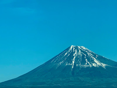
| 1) 富士山 標高は、3775.56m。 日本最高峰、独立峰 (ドクリツホウ) です。 富士山が好まれるの理由は、もちろん形の美しさと、高さも ありますが、独立峰として'孤高の存在' で 気高く感じられるからだと思います。 1) Mt.Fuji The altitude is 3,775.56m. It is the highest peak in Japan and an independent peak. The reason Mount Fuji is so popular is, of course, its beautiful shape and height, but I think it's also because as an independent peak, it feels noble with its 'Stand-alone Presence'. |
14 Views of Mt. Fuji From the Train Window
It is not a given that you can see and photograph Mt. Fuji from the Shinkansen.
I didn't know that when I saw the beautiful Mount Fuji from the Shinkansen by chance.
Today we were very lucky!
Our seats were facing the mountain, and we were blessed with good weather.
From the incredible number of photographs I took of Mt. Fuji, I have selected 14.
 |
| 2) 富士山 1936年、富士箱根伊豆国立公園に指定。 1952年に特別名勝、2011年に史跡。 2013年に世界文化遺産登録: 。 2) Mt.Fuji In 1936, it was designated as part of Fuji-Hakone-Izu National Park. In 1952, it was designated a Special Place of Scenic Beauty, and in 2011, a Historic Site. In 2013, it was registered as a World Heritage Site. |
 |
| 3) 富士山 / Mt.Fuji |
C. 歌:"ふじの山" / Song : "Fuji no Yama"
この歌は、童謡にあたりますが、私は子供の頃には知りませんでした。
高校生の時に、この歌を何かのドラマで知りました。
 |
| 4) 富士山 / Mt.Fuji |
Song : "Fuji no Yama"
It may not be sung often these days, but I really like the song about Mount Fuji, "Fuji no Yama" : ★ / ★.
This song is a nursery rhyme, but I didn't know it when I was a child.
I first heard about it in a TV drama when I was in high school.
 |
| 国際宇宙ステーションから見た春の富士山 Mt. Fuji In Spring As Seen From the International Space Station 画像は下記より / This from below ★ |
 |
| 5) 富士山 / Mt.Fuji |
D. 活火山 / Active Volcano
富士山は、活火山 (カッカザン) で、噴火する可能性があります。
最後の噴火は、1707年、'宝永大噴火 (ホウエイダイフンカ)' と呼ばれています。
きっと登山者は、
「今は噴火しない」
と信じて登っているのでしょう。
私は富士山に登ったことはありませんし、これからも登る予定もありません。
あっ、理由は、私が 'ヘタレ' だからです。
 |
| 6) 富士山 / Mt.Fuji |
Active Volcano
Mt. Fuji is an active volcano and there is a possibility of it erupting.
The last eruption was in 1707, known as the 'Great Hōei Eruption'.
I'm sure the climbers are climbing with the belief that "it won't erupt now."
I have never climbed Mount Fuji, and I have no plans to do so in the future.
Ah, the reason is that I'm a wimp.
 |
| 7) 富士山 真ん中、削れているところ(穴)は、宝永大噴火の跡です。 噴火跡の右下は宝永山 (ホウエイザン)で、 宝永大噴火によって誕生しました。 富士山最大の側火山 (ソクカザン) です。 7) Mt.Fuji |
 |
| 日本の活火山 (2017年時) Active Volcanoes in Japan, 2017 画像は下記より / This from below ★ |
.jpg) |
宝永噴火を描いた絵図「夜ルの景気」 (静岡県沼津市土屋博氏所蔵) "Yoru no Keikei" (The Night View) Drawing of the Great Hōei Eruption. (Owned by Hiroshi Tsuchiya, Numazu City, Shizuoka Prefecture) 画像は下記より / This from below |
 |
| 8) 富士山 今回の富士山の写真でこれが一番好きです。 8) Mt.Fuji This is my favourite photograph of Mt. Fuji from this time. |
 |
| 9) 富士山 / Mt.Fuji |
 |
| 10) 富士山 / Mt.Fuji |
 |
| 11) 富士山 / Mt.Fuji |
E. ジグザク / Zigzag
a) 'ブルドーザーが登る道' について
ブルドーザーの専用道は、驚くことに、富士山町まで達しています。
登山道には、ブルドーザー道と登山道を兼ねる道と、ブルドーザーの専用道があります。
ブルドーザー道には、道標がなく、通常、「立入禁止」の看板があります。
登山道沿いに建てられた山小屋や頂上の売店、郵便局で使う資材や商品をブルドーザーが運んでいます。
富士山頂郵便局へは、郵便物だけでなく、スタッフもブルで行き来しているそうです。
About the 'Bulldozer Climbing Road'
The bulldozer-only roads reach all the way from Mt. Fuji Town, surprisingly.
There are bulldozer-only parts of the roads and parts that are also for climbers.
There are no guideposts on the bulldozer trails, and there are usually "No Entry" signs.
Bulldozers carry materials and goods used by the mountain huts built along the trails, the summit shop, and the post office.
I heard that not only mail but also staff travel to and from the Mt. Fuji Summit Post Office by bulldozer!
 |
| 13) 富士山 / Mt.Fuji |
b) '森林限界'について
下記、"そらの下Styke" サイトから。
"富士山のような美しい山でも、表面は尾根と谷があり凸凹しています。
この尾根と谷の凸凹によって日の当たりが異なったり、地面の乾燥具合が異なるため、木が生えやすい場所、木が生えにくい場所ができてきます。
このため、森林限界は一つの山でさえ、一定の高さに区切ることができず、結果として富士山の絵の白い部分と青い部分によって、森林限界のギザギザと表現されるわけです。"
About The Tree Line
According to "Sora no Shita Styke" website about the 'tree line' only in Japanese, (translated by me)
"Even a beautiful mountain like Mt. Fuji has an uneven surface with ridges and valleys : 凸凹.
The unevenness of these ridges and valleys causes differences in the amount of sunlight they receive and the dryness of the ground, resulting in some places where it is easier for trees to grow and others where it is not.
Because of this, the tree line cannot be divided at a fixed height even on a single mountain, and as a result, the white and blue areas in a picture of Mt. Fuji give the tree line its jagged appearance."
 |
| 14) 富士山 / Mt.Fuji |
F. 浜名湖 / Lake Hamana
 |
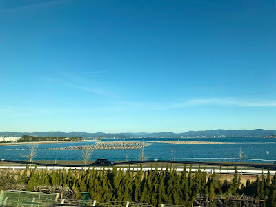
| 浜名湖と 遠州灘 (大平洋) 繋がり、汽水湖 になりました。 Lake Hamana is a brackish lake in Shizuoka Prefecture. It was originally a freshwater lake, but the 1498 Meiō Earthquake and subsequent high tide caused the sandbar to collapse, connecting it to the Enshū Nada (Pacific Ocean), and turning it into a brackish lake. |
浜名湖といえば、私は、すぐ鰻!を思い浮かべます(笑)。
なのに、自覚して浜名湖産の鰻を食べたことがありません。
今回も食べませんでした。
いつか....ウナギの水産量が減っていると聞きます。
また、外国産の鰻を輸入して、浜名湖産を名乗る場合もあると聞きます。
浜名湖産の鰻を食べる時は、よく吟味しなくては!
 |
| 浜名湖を車窓から Lake Hamana From the Train Window |
Lake Hamana
When I think of Lake Hamana, I immediately think of eel! (Laugh)
But even so, I have never consciously eaten eel from Lake Hamana.
I didn't eat it this time either.
I've heard that the amount of eel produced is decreasing.
I've also heard that eels are sometimes imported from overseas and called "eels from Lake Hamana".
I have to think carefully before I eat "eels from Lake Hamana"!
 |
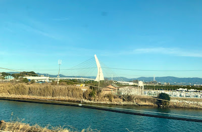
新居跨線橋 新居跨線橋 (コセンキョウ)は、1968年竣工。 この橋は、東海道線、新幹線の上にかかっています。 橋の向こうが浜名湖です。 【追記】2025年4月28日 橋は、撤去される方針です。 Kosenkyo Bridge The Kosenkyo Bridge was completed in 1968. This bridge spans the Tokaido Line and the Tokaido Shinkansen. 【Postscript】28th of April 2025 The bridge is set to be removed. |
 |
| 浜名湖競艇場 左の白い三角の建物は、'サンマリンブリッジ' です。 浜名湖競艇場 (ハマナコキョウテイジョウ)へ渡る橋です。 浜名湖に競艇場があることを初めて知りました。 写真の右手に浜名湖競艇場があります。 Lake Hamana Boat Racecourse The white triangular structure on the left is the 'Sun Marine Bridge'. The bridge crosses to the Lake Hamana Boat Racecourse. This was the first time I heard that there is a boat racecourse on Lake Hamana. The Lake Hamana Boat Racecourse is to the right hand side of the photograph. |
 |
| 'サンマリンブリッジ' 1996年竣工 / 全橋長は260m 車窓から橋の全形は撮影できませんでした。 'Sun Marine Bridge' Completed in 1996 / Total bridge length is 260m I couldn't get a photograph of the entire bridge from the train window. |
G. 伊吹山 / Mount. Ibuki
 |
| 伊吹山地 伊吹山地(イブキサンチ)は、岐阜県と滋賀県にまたがる山地です。 雪をかぶっているのは伊吹山 (イブキヤマ)でしょうか? 伊吹山だと思うのですが.... 伊吹山は、伊吹山地の最高峰で、標高1,377 mです。 Ibuki Mountains The Ibuki Mountains are a mountain range that straddles Gifu Prefecture and Shiga Prefecture. Is the snow-capped mountain Mt. Ibuki? I think it is Mt. Ibuki... Mount Ibuki is the highest peak in the Ibuki mountain range, with an elevation of 1,377 m. |
 |
| 車窓からの伊吹山 山頂には、日本武尊 (ヤマトタケル / 712 -720 ~ 721 - 807) の石像があるそうです。 ここから見えませんね〜。 Mt. Ibuki from the Train Window There is apparently a stone statue of Emperor Yamato Takeru (712 -720 ~ 721 - 807) who was a Japanese folk hero, at the top of the mountain. We can't see it from here. |
 |
| 山域は琵琶湖国定公園(ビワココクテイコウエン)に 指定されています。 Rはまだ琵琶湖へ行ったことがないので、 いつか彼を連れていってあげたいと思います。 【追記】2025年4月28日 2024年11月に実現しました。 The mountain range is designated as Lake Biwa Quasi-National Park. R has never been to Lake Biwa yet, so I would like to take him there some day. 【Postscript】28th of April 2025 This was realized in November 2024. |
伊吹山撮影後は新幹線から撮影せず、岡山駅到着後に撮影を始めました。
After photographing Mt. Ibuki, I did not take any photographs from the Shinkansen, but started taking photographs after arriving at Okayama Station.


.jpeg)

