
目次 / Contents
1) 外周コース / Outer Circumference Course
2) 桜を見つけながら / While Finding Cherry Blossoms
A. 大島桜 / Prunus Speciosa
B. 見上げれば..../ If I look up ...
3) うさぎ山分岐点 / Mt. Rabbit Junction
4) 地図にない道 / Path Not on Map
5) 雨乞いの池上 / Above Rainmaking Pond
1) 外周コース
Outer Circumference Course
鎌倉広町緑地は、鎌倉市の南西部にある、広さ約48ha (東京ドーム約10個分、480,000㎡) の都市林です。
「都市林」:主として動植物の生息地または生育地である樹林地等の保護を目的とする都市公園"
今日、私と夫Rは、大桜の後、まだ歩いたことがない、'⑫雨乞いの池上' 方面への外周コースを目指しています。
サイトでは、"一周の所用時間は約1時間半~2時間"とあります。
私達は通常よりゆっくり歩き、興味をひく場所で足を留めますし、
私は撮影のためにも頻繁に立ち止まります。
外周コースを一周する計画ではありませんが、"約1時間半~2時間"は、最低限の目安になりました。
 |
'大桜'を見た後は、外周コースに戻り、 ⑩ うさぎ山分岐点へ向かいました。 After seeing 'Ozakura', returned to the Outer Circumference Course and headed to ⑩ Usagiyama Junction : Mt. Rabbit Junction.  |
Outer Circumference Course
Kamakura Hiromachi Ryokuchi is an 'Urban Forest' : 'Toshirin' with an area of about 48ha in the southwestern part of Kamakura City.
I first knew the word, 'Urban Forest' : 'Toshirin' on the official website (only in Japanese) of Kamakura Hiromachi Ryokuchi, below.
" 'Urban Forest' : A city park whose purpose is mainly to protect the habitats of animals and plants."
(Translated by me)
Today, after the Big Cherry Tree ; 'Ozakura' I and my husband R were aiming for the Outer Circumference Course in the direction of
'⑫ Above Amagoi Pond : Above Rainmaking Pond', which we have not walked yet.
The website says, "The time required for one lap is about one and a half to two hours."
We walk slower than usual, stop in places of interest, and I often stop for photographing.
We do not plan to go around the whole of the Outer Circumference Course, but "about one and a half to two hours" was the minimum guideline.
2) 桜を見つけながら
While Finding Cherry Blossoms
A. 大島桜 / Prunus Speciosa
 |
| 見上げると、多くの場所で高い位置に桜が咲いていました。 鎌倉広町緑地の殆どの桜はオオシマザクラ(大島桜)です。 When I looked up, cherry trees were blooming in high places, in many places. Most cherry trees in Ryokuchi are Prunus Speciosa : Oshima- zakura |

 |
| 地面の花びらで桜の存在に気がつく時がありました。 There were times when I noticed the existence of cherry blossoms petals on the ground.    |
B. 見上げれば... / If I look up ...
 |
たくさんの花びら! / Lots of Petals! 花、丸ごと、落ちています。 Whole flowers are falling. |
 |
| 見上げると、そこには桜が咲いていました。 桜の花を見つけることが喜びになりました。 When I looked up, I could find cherry blossom. It was a pleasure to find the cherry blossoms. |
 |
| 空を背景に咲く桜を見つけることが 面白い遊びになりました。 Finding the cherry blossoms that bloom against the sky became an interesting play. |
 |
| 離れて見たり、振り返ったりすると違う景色の中に 桜があります。 If I look at it from a distance or look back, I could see cherry blossoms in a different landscape. |
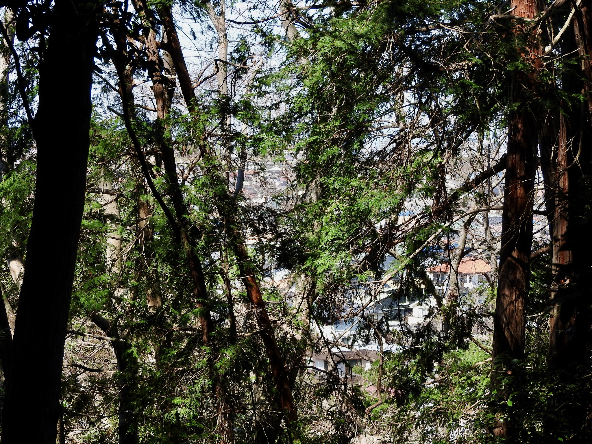 |
| 木々を通して七里ヶ浜住宅街が見えます。 I can see the Shichirigahama residential area through the trees. |
3) うさぎ山分岐点 / Mt. Rabbit Junction
 |
| 階段を登った先に、'⑩ うさぎ山分岐点' があります。 At the end of the steps, there is '⑩ Usagiyama Junction': Mt. Rabbit Junction.  |
 |
| ここでは、よく他の人々に会います。 多くの人が立ち止まるせいなのかもしれません。 特別景色が良いというわけではありませんが、 狭い山道を歩いてきた人にとっては、 このオープンスペースは、ちょっとした安らぎと 気分転換になるのだと思います。 We often meet other people here. Maybe it's because many people stop. It’s not that the scenery is so special, but for those who have walked on narrow mountain paths, this open space will be a little relaxing and refreshing.  地図上の番号は地図が設置されている場所を示します。 The numbers on the map indicate where the map is located.  その昔、ここに大砲があったという話を聞きました。 本当でしょうか? I heard that there was a cannon here a long time ago, Really? |
 |
| ヒョロ長い印象の桜の木に桜が咲いています。 Spindly cherry trees are blooming.    |
4) 地図にない道 / Path Not on Map
 |
| 私達は、'⑩ うさぎ山分岐点' から '⑫ 雨乞いの池上'へ行きたいと 思っていました。 が、地図では、緑地内にそれらを結ぶ道がありません。 外周コースが途切れています。 一度、緑地外へ出て再び緑地へ入る道が点線で誘導されています。 それらを記憶して私達は、'⑩ うさぎ山分岐点'を後にしました。 We wanted to go from '⑩ Mt. Rabbit Junction' to '⑫ Above Rainmaking Pond'. However, on the map, there is no way to connect them in Ryokuchi. Outer Circumference Course is interrupted. The route goes out of Ryokuchi and enters Ryokuchi again guided by the dotted line. Remembering them, we left '⑩ Mt. Rabbit Junction'. |
外へ出る道を探して標識に気をつけて歩きつつ、植物や景色などにも目を留めます。
軍隊やスポーツクラブの訓練歩行ではないのですから、一心不乱に進むことが目的ではありません。
ネット検索で要点だけをつまみ食いするのでなく、一歩一歩自分の足で歩き、必要、不必要に関係なく、その環境を享受することが散策の良さだと思います。
Look for a way out, pay attention to the signs, and keep an eye on the plants and scenery.
It's not a training walk for the military or sports clubs, so our purpose is not just to finish.
I think the good thing about walking is that I walk step by step with my own feet and enjoy the environment regardless of whether it is necessary or not, instead of just picking up the main points by searching the Internet.
 |
| 何の実?花? この木を知ったのはここが初めてだったのですが、 実は鎌倉山のいつもの散策道にもありました。 また、緑地内でもかなりありました。 What's the fruit? or flower? This was the first time I noticed this tree, but one is actually on the usual walking path in Kamakurayama. There were also quite a few in the green space. 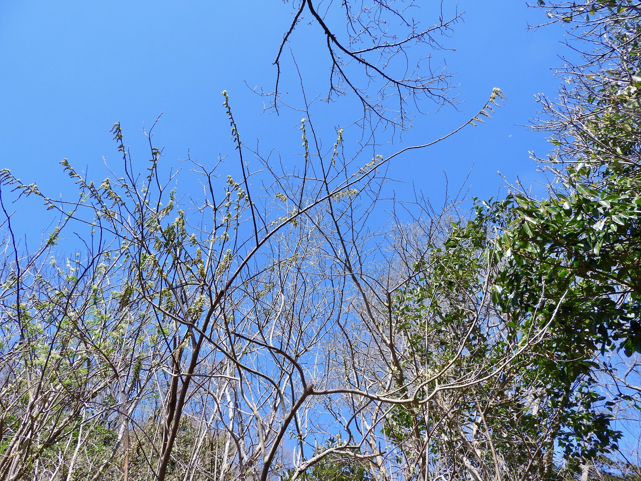 きっとキブシ! 'ムクロジ'に似ていますが、違いますよね? 'キブシ' でしょうか? キブシならば、黄色い花です。 Sure Stachyurus Praecox ! It's similar to 'Sapindus Mukorossi', but not, right? Is it 'Stachyurus Praecox' : Kibushi ? Stachyurus Praecox is a species of flowering plant in the family Stachyuraceae, native to Japan. If it is 'Stachyurus Praecox', they are yellow flowers. |
外へ出る脇道には通行止めの告知がされていました。
疑問に思いつつ、進むと分かれ道がありました。
The notice said 'Dead End' on the side path towards the outside.
While wondering, there was a fork in the paths.
 |
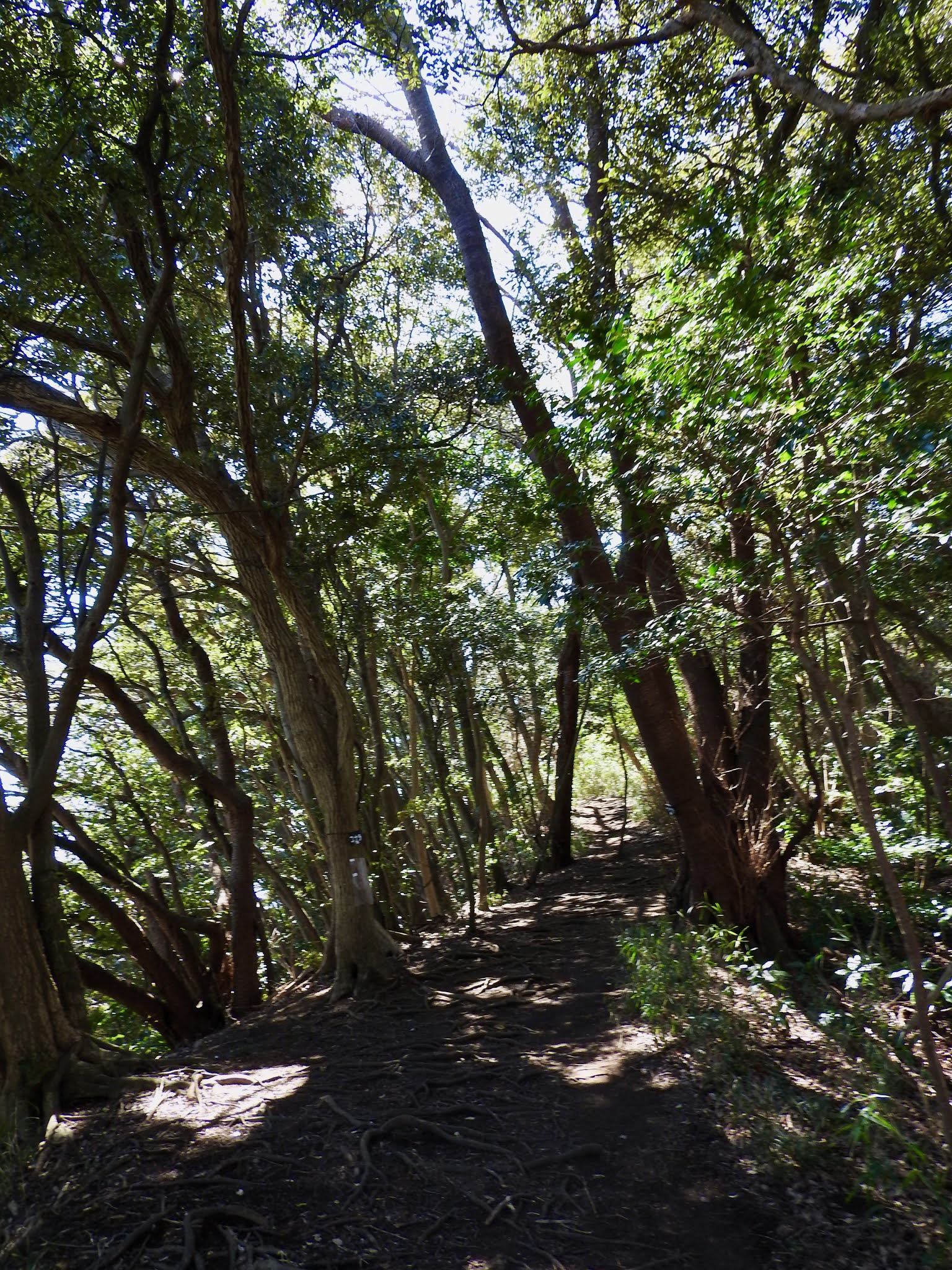
| 左 : 外周コース / 右 : 'きはちの窪' ・'竹ヶ谷' 2月にもここに来ました。 その時は右へ進みました。 Left : Outer Circumference Course Right : 'Kihachi no Kubo': Kihachi Sunken Place & 'Takegaya' : Takegaya Valley We came here in February as well. At that time, I went to the right. 2月の散策は下記。/ Walk in February, below. ① 2021年2月3日 散策 - 鎌倉広町緑地 - 浄水センター分岐点 / Take  今回は左の外周コースを選びました。 ですが、地図上ではこの道は行き止まりなので、 心許なく歩きました。 This time we chose Outer Circumference Course on the left. However, on the map, this path is a dead end, so while I walked I felt a little bit worried. |
 |
| 外周コースは相模湾側にあるので、隙間があると 七里ヶ浜住宅街が見えます。 ここからは海は見えませんでした。 Outer Circumference Course is on the Sagami Bay side, so if there is a gap, you can see the Shichirigahama residential area. I couldn't see the sea from here. |
 |
| 木の影と地上に露出した根が絡み合っています。 The shadow of the tree and the roots exposed on the ground are intertwined. |
 |
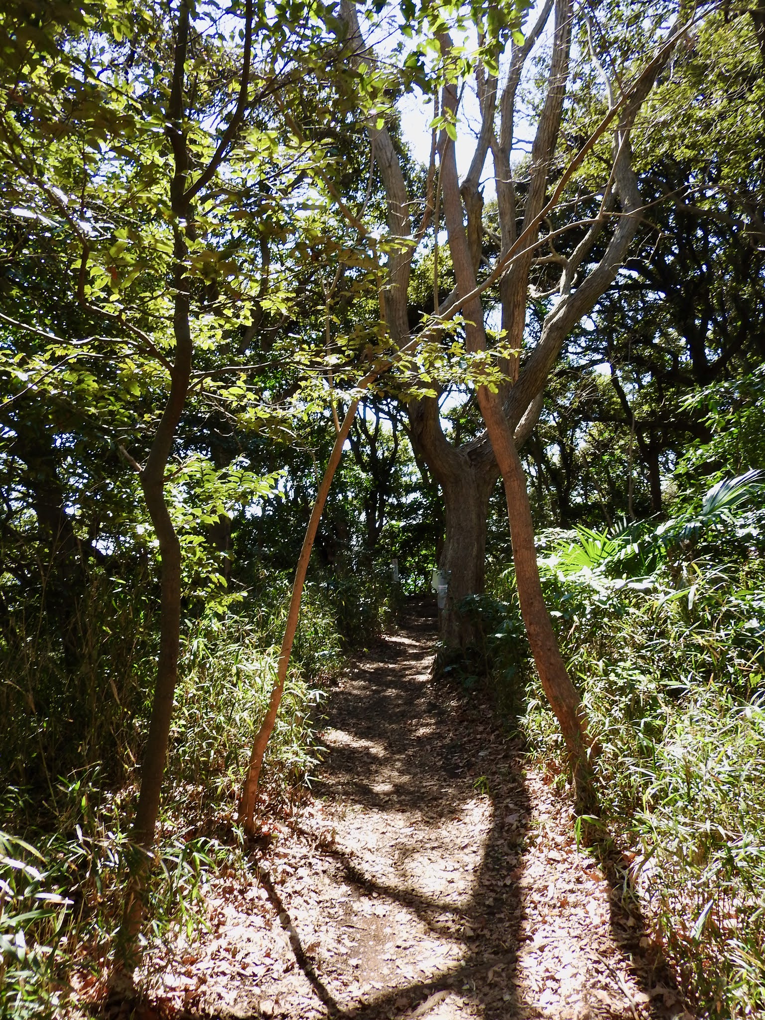
| 昔の街道のような雰囲気を感じ、 時代を遡って歩いているような気分になります。 It feels like Kaidō and makes you feel like you are walking back in time. According to Wiki about Kaidō, "Kaidō (街道, 'road') were roads in Japan dating from the Edo period. They act important roles in transportation like the Appian way of ancient Roman roads." |

 |
| 両脇の木が斜めになっていて、 門もしくは鳥居のように思えました。 The trees on both sides were slanted in and looked like a gate or Torii. |
R、三連写 / Triple Photographs of R
 |
門に向かう、R 「マスク、つけて〜!」 と声をかけました。 Rは、山道では殆どマスクをつけていません。 (マスクをずらして着用しています) この時は私がここで撮影し、ブログに載せたいと 企画したのでマスク着用をお願いしました。 Heading to the Gate, R I asked him, "Please wear your mask!" R hardly wears his mask on mountain path. (He wears it with the mask shifted) At this time, I planned to photograph here and post it on my blog, so I asked him to wear a mask.  |
 |
| 門を通り抜ける、R ご協力、感謝! Come Through the Gate, R Thank you for your cooperation! |
 |
| 根が階段の役割をしています。 ここを登ります。 The roots act as steps. Climb here. |
 |
| 登って振り返るとRがやはり根の坂 (階段) を撮影していました。 彼は見えますか? After I climbed up and looked back, R was still photographing the root slope (steps). Can you see him?  登って来ます。 / He will climb. |
 |
| 光がそそぐ尾根 The Light on the Ridge |
 |
| 'この子' 外周コースの脇道に入ってみました。 その脇道は結局は外周コースに戻ります。 その脇道の真ん中に、'この子'がいました。 故意に植栽されたのでしょうか? 'This Child' I entered the side path of Outer Circumference Course. The side path eventually returns to Outer Circumference Course. There was 'this child' in the middle of the side path. Was it intentionally planted?  |
 |
| ヤブツバキ 'ヤブツバキ ' (藪椿) の標識がついています。 ツバキ(椿)とヤブツバキはどう違うのでしょうか? この他に、'ユキツバキ'という椿もあるのですね〜。 Camellia Japonica There is a sign of 'Yabutsubaki' : Camellia Japonica. What is the difference between Camellia and Camellia Japonica? In addition to this, there is also a camellia called 'Yukitsubaki' : Camellia Rusticana.  |
 |
| 山の中で一層赤い花は華やかです。 The red flowers are more gorgeous in the mountains. |
 |
| 山道に椿が散っているのは不思議な気持ちになります。 私が山道をあることがあまりないからなのかもしれません。 赤い花は山道でとても魅力的です。 It makes me feel strange that camellias are scattered along the mountain path. Maybe it's because I rarely walk along mountain trails. Red flowers are very attractive on mountain paths. |
樹形の面白さ/ Fun Tree Shape

 |
| 紐で結ばれています。 They are tied with a string.  幹が割れてもまだ聳え (ソビエ) 立っています。 Even if the trunk is broken, it still rises. |
5) 雨乞いの池上 / Above Rainmaking Pond
 |
| この地図には、道が記されていませんが、 現在は道が通っています。 私達が疑心暗鬼でしたが、緑地を出ることなく、 '⑫雨乞いの池上'に到着できました。 その後は外周コースに沿って、'⑬相模湾眺望'へ向かいました。 There is no path shown on this map, but it is currently there. We were sceptical, but we were able to arrive at '⑫ Above Rainmaking Pond' without leaving the Ryokuchi. After that, we headed to '⑬ Sagami Bay View Point' along Outer Circumference Course. |
'⑫雨乞いの池上' の場所からは、'雨乞いの池' は見えません。
'雨乞いの池'は、緑地外で、
霊光寺 (神奈川県鎌倉市七里ヶ浜1-14-5)
の境内にあります。
'雨乞いの池'は、日蓮 (1222 - 1282) の雨乞い伝説の池です。
下記、鎌倉タイムから。
"干ばつに苦しんだ1271年、
時の執権北条時宗 (1251 - 1284 / 在職 : 1268 -1284)
は極楽寺の名僧・忍性に雨乞いを命じるものの効果がありません。
次に日蓮がここ田辺ヶ池の淵に立ち「南無妙法蓮華経」と唱えると
大雨に恵まれたという伝説の地。"
忍性は貧民やハンセン病患者など社会的弱者の救済に尽力し、彼らのための医療施設を創設しました。
忍性、極楽寺については下記。
霊光寺には、私達はまだ行ったことはありません。
機会があれば、池にも行ってみたいと思います。
 |
| 霊光寺 下記、霊光寺 について、Wikiより "明治時代末、「日蓮大菩薩祈雨之旧蹟地」の石塔が出土したため 日蓮上人像と本堂が建立されたのが始まりである。" Reikouji-Temple According to Japanese Wiki about About Reikoji-Temple, "The origin was that at the end of the Meiji era, the stone monument of 'Nichiren Daibosatsu prayer rainmaking historic site' was excavated and the statue of Nichiren and the main hall were erected." (Translated by me) 画像は下記より / This from below ★ |
Above Rainmaking Pond
From the location of '⑫ Above Rainmaking Pond', I cannot see 'Rainmaking Pond'.
'Rainmaking Pond' is located outside the Ryokuchi and in the precincts of Reikoji-Temple (1-14-5 Shichirigahama, Kamakura City, Kanagawa Prefecture).
'Rainmaking Pond' is the legendary rainmaking pond of Nichiren (1222 - 1282) who was a Japanese Buddhist priest and philosopher
of the Kamakura period (1185–1333), who developed the teachings of Nichiren Buddhism, a branch school of Mahayana Buddhism.
"In 1271, when people suffered from drought,
ordered to the famous priest, Ninsho of Gokurakuji-Temple to pray for rain, but it had no effect.
Next, when Nichiren stood at the edge of Tanabegaike-pond and chanted "Nanmu Myōhō Renkakyo", it became blessed with heavy rain, so it has become a legendary place."
The priest, Ninshō (1217 - 1303) opened Gokurakuji - Temple in 1259.
Ninshō had been instrumental in helping vulnerable groups such as the poor and leprosy patients, and had created medical facilities for them.
About Ninshō and Gokurakuji - Temple, below.
We haven't been to Reikoji-Temple yet.
If I have a chance, I would like to go to the 'Rainmaking Pond'.
0 件のコメント:
コメントを投稿