
 |
| 熊野・南紀旅行 11月12 - 14日 Kumano and Nanki Trip 12 -14th of November Kii Peninsula Trip |
 |
| 添乗員さん作成の予定表 実際の順番はいくつか変更になりました。 Schedule Created by Our Tour Conductor The actual order was changed. |
目次 / Contents
1) 瀞峡 / Dorokyo Gorge
2) 水路 / Water Way
3) ウォータージェット船クルーズ / Water Jet Boat Cruise
A. 係留所 / Mooring
B. 出発 / Departure
C. 空にも川? / Also, River in Sky?
4) 峡谷 / Gorge
5) 下瀞と上瀞 / Downstream Gorge and Upstream Gorge
6) 下船 / Disembark
1) 瀞峡 / Dorokyo Gorge
熊野速玉大社 (クマノハヤタマタイシャ) 参拝のあと、
瀞峡 (ドロキョウ)で ウォータージェット船に乗りました。
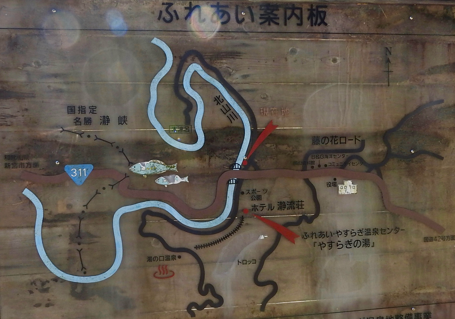
特に、瀞八丁 (ドロハッチョウ)と呼ばれる地域 (下の地図) は、巨石
奇岩などの見所が多く有名な観光地になっています。
瀞峡周辺には、約7,000万年前 (中生代; クロマニョン人の時代) の断層、竜神付加体 (リュウジンフカタイ) が分布しています。
約7,000万年前は恐竜が生息していた時代なので、竜神と名付けられたのでしょうか?

Dorokyo Gorge
After worshiping at Kumano Hayatama Taisha Shrine, we had boarded a Water Jet Boat Cruise : ★ in Dorokyo Gorge : ★.
Dorokyo Gorge is located upstream of the Kitayama River (Kumano River system) that flows through Wakayama, Mie, and Nara prefectures, and is located in Yoshino Kumano National Park.
It is designated as National Designated Cultural Properties, "Special Places of Scenic Beauty and National Monuments".
In particular, the area called 'Doro-Hatcho' (See below Map) is a famous tourist destination with many attractions such as megaliths and strange rocks.
A fault of about 70 million years ago (Mesozoic Era; Cro-Magnons Era), Ryujin Accretionary Prism : 'Dragon God Accretionary Prism' is distributed around the Dorokyo Gorge.
It was about 70 million years ago when dinosaurs lived, so was it named Ryujin : Dragon God?
 |
| 瀞八丁 / Doro-Hatcho We boarded a boat from Ogawaguchi to Tado. 画像は下記より / This from below ★ |
2) 水路 / Water Way
船で下りました。
本宮大社と速玉大社は川で結ばれ、"川の参詣道"となっています。
"川の参詣道"も世界遺産『紀伊山地の霊場と参詣道』に含まれています。
私は瀞峡でのクルーズは、瀞峡が観光名所であるだけでなく、"川の参詣道"の雰囲気を多少なりとも感じるために企画されていたと理解しています。
私達は、ウォータージェット船に乗りましたが、船頭さんが手漕ぎの船で案内する "川の参詣道熊野川舟下り" もあるようです。
(小型エンジンつきの和船もあるようです)
そちらの方が雰囲気はあるのかもしれません。
三反帆 (サンダンポ) : 川風を受けて進む川舟の船の旅もあるようです。
 |
| Red Circle ● : Sacred Sites and Pilgrimage Routes in the Kii Mountain Range 33°50′13″N 135°46′35″E 画像は下記より / This from below ★ |
Water Way
A section of the waterway was used by "Kumano-gokō" (Royal ; Emperor family visited "Kumano Sanzan" : Kumano Hongū Taisha Shrine, Kumano Hayatama Taisha Shrine, Kumano Nachi Taisha Shrine as pilgrims).
The Emperor and his party visited Kumano Hongū Taisha Shrine via
Nakahechi Road one of Kumano Kodō, and then sailed down Kumano River to Kumano Hayatama Taisha Shrine.
Hongū Taisha Shrine and Hayatama Taisha Shrine are connected by a river, forming a "River Pilgrimage Route".
"River pilgrimage route" is also included in World Cultural Heritage Site of the Sacred Sites and Pilgrimage Routes in the Kii Mountain Range.
I understand that the cruise in Dorokyo Gorge was planned not only to make Dorokyo Gorge a tourist attraction, but also to give a sense of the "River Pilgrimage Route".
We got on a water jet boat, but there seems to be the boatman guides by rowing boat
(There seems to be a Japanese boat with a small engine)
There may be more atmosphere there.
There seems to be a Sandanpo boat trip by a river boat with three sails that receives the river breeze.
3) ウォータージェット船クルーズ
Water Jet Boat Cruise
A. 係留所 / Mooring

 |
| 板屋川 板屋川は北山川の支流です。 Itaya River Itaya River is a tributary of Kitayama River. |
 |
| 板屋川 水が怖いくらい透明.... Itaya River The water is so transparent that it's awesome... |
 |
| 秋の桜 11月なのに桜が咲いています。 那智大社でも違う種類の桜でしたが、咲いているのを見ました。 和歌山は暖かいのですね〜。 Cherry blossoms in Autumn Even though it's November, the cherry blossoms are in bloom. It was a different kind of cherry blossom at Nachi Taisha, but I saw it blooming. Wakayama is warm, isn't it?  |
 "小川口係留所" "小川口係留所"(オガワグチケイリュウジョ)で ウォータージェット船を待ちました。 '渓谷'と聞いていましたが、係留所は、 広い河と開けた空間でのんびりとしていました。 待ち時間が長くは感じませんでした。 |
 "Ogawaguchi Mooring" We waited for a Water Jet Boat at "Ogawaguchi Mooring". I heard that it was a 'gorge', but the Point was relaxing in a wide riverbank and open space. I didn't feel the waiting time was long. |
 |
| "小川口係留所" すでに1艘 (ソウ) のボートが停泊しています。 このあとにくるボートに私達は乗り込みます。 "Ogawaguchi Mooring" One boat is already moored. We will board the boat that comes after this. |
 |
| 北山川 のびのびとした空間で、気持ちが良いです。 あのボートは、志古乗船所に戻ります。 Kitayama River It feels good in a relaxed space. That boat will return to Shiko Boarding Point. |
 |
| 私達が乗る船がやってきました。 The boat we will be on has been arriving. 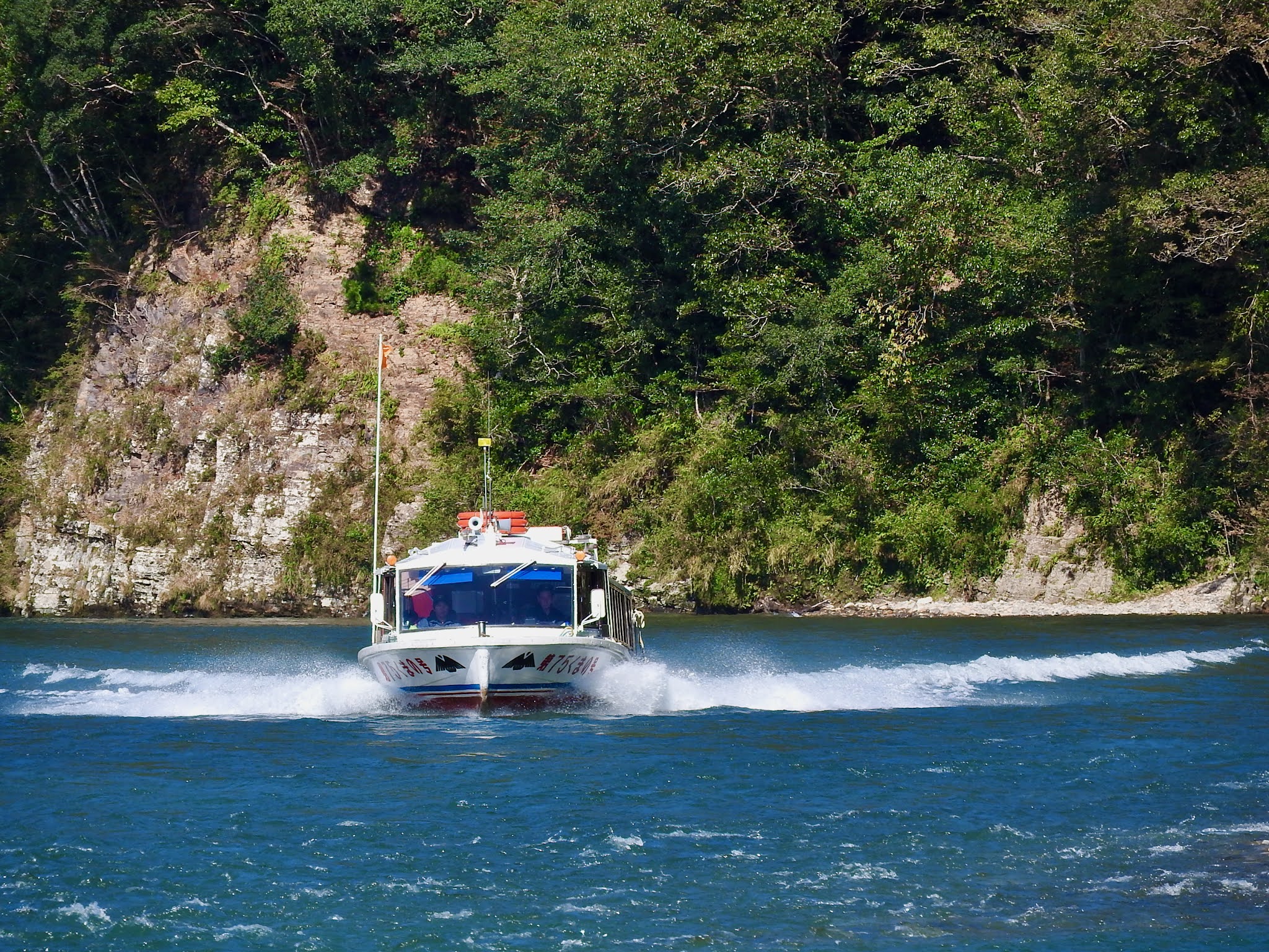 |
 |
| くまの号 これに乗ります。 Kumano We will ride this. |
 |
| くまの号のマーク ; 八咫烏 Mark of Kumano ; Yatagarasu  八咫烏 (ヤタガラス) がマークになっています。 KKKは熊野三山と三本足の意味で(と思う)、 アメリカのあの恐ろしいグループ(KKK)とは関係はありませんよ! でも最初見たときは、ちょっとドッキリしました。白抜きだし...。 Yatagarasu is the mark for a boat. Yatagarasu is a three-legged crow used by the God of Kumano. KKK means (I think) Kumano Sanzan and three legs has nothing to do with that group in America (KKK)! But when I first saw it, I was a little surprised..it's white ... |
B. 出発 / Departure
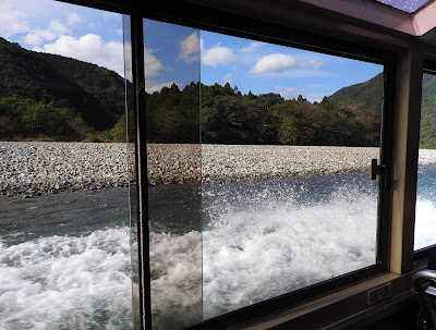 |
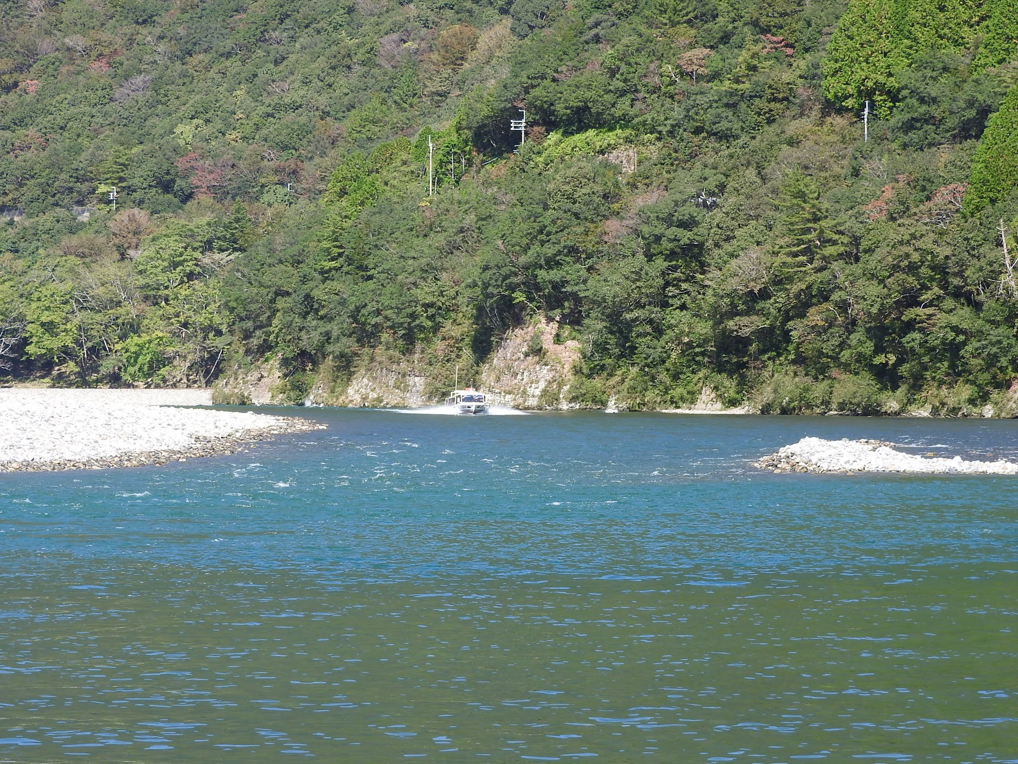
| すごい水しぶき! 時速40km おお〜っと思わず、声を挙げそうになります。 Great splash! 40km / h Wo~w! I was about to raise my voice.  詳細を忘れてしまったのですが、 この船はとても浅いところでも (60cm?) 推進しできるのだと説明されたように思います。 I forgot the details, but I think it was explained that this boat can be propelled even in very shallow areas (60 cm?).  水のエメラルドグリーンと航跡の白 きっとどれもが感動する川の色 Emerald green of water and white of wake The colour of the river that surely impresses everybody. |
C. 空にも川? / Also, River in Sky?
 |
| 川のような空 船から空を見あげます。 Sky like a River Look up at the sky from the boat.  うろこ雲 うろこ雲ですね。 秋〜〜! Uroko-gumo It's a Uroko-gumo : Scale cloud, isn't it? In Japan, Cirrocumulus cloud is often referred to as Scale cloud : Uroko-gumo in Japanese and Uroko-gumo is an autumn season word. |
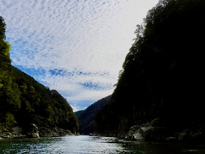
私は、川や崖、岩に感動しましたが、空にも感動して複数枚の空の
写真を撮りました。
雲のあり方が波を思わせ、瀞峡では視界が限られ、カメラのフレームにもかぎりがあり、川に思えます。
また、私の撮影では捉えきれなかったのですが、水面に崖が映り込み、水面下にファンタジー世界が広がっていました。
ここでは、空と地上と水面下が個別に、または一緒になって楽しませてくれます。
残念なことは、ジェットボートの航跡で水面の世界が消されしまったり、ボートからの視界は限られるので、峡谷の全風景を肉眼でもカメラでも見ることができないことです。
そういう面からゆくと、手漕ぎの船は、情緒もあり、全風景を穏やかに楽しむことができるのかもしれません。
 |
| 峡谷の上を流れる川 船の天井は開けています。 天気の良い日でよかった! River Flows Over Gorge The ceiling of the boat is open. I'm glad it was a lovely day!  |
I was impressed by the river, cliffs and rocks, but I was also impressed by the sky and took a few photographs of the sky.
The clouds are reminiscent of waves, the visibility is limited in Dorokyo Gorge, and the camera frame is limited, making it look like
a river.
Also, although I couldn't capture it in my photographing, a cliff was reflected on the surface of the water, and a fantasy world spread under the surface of the water.
Here, the sky, the ground and the underwater are entertaining individually or together.
Unfortunately, the wake of a jet boat erases the world on the surface of the water, and the view from the boat is limited, so I cannot see the entire view of the gorge with the naked eye or with a camera.
From that point of view, the rowing boat may be more emotional and
I may be able to enjoy the whole landscape calmly.
 |
| 私のカメラでは捉えられませんでしたが、 ここで写真を上下して一緒に見ると 比較的似た世界が感じられます。 I couldn't capture it with my camera, but when I look up and down the photos here, I feel a relatively similar world.  |
 |
 |
 |
 |
4) 峡谷 / Gorge
 |
| 大雨で岩が転がり落ち、木を倒したように見受けられます。 The heavy rain caused the rocks to roll down and appeared to have knocked down trees. |
 |
| 木々が少し色づいています。 崖の侵食の具合、苔もしくは他の植物の緑、 そして川の色などの組み合わせが素敵です。 The trees are a little colored. The combination of cliff erosion, moss or other plant greens, and river colours is wonderful.  |
 |
| 亀岩 この名前は、甲羅干しをしている亀の姿に似ている ところに由来しています。 30畳 (48.60㎡) 余りの広さです。 Kame-iwa : Turtle Rock The name comes from the fact that it resembles a turtle drying its shell. It is over 30 tatami mats (48.60㎡).  瀞峡には印象的な形の岩がたくさんあり、 名前が付けられている岩も複数あります。 名があっても、その名を疑問に思う岩が中にはあります。 ですが亀岩は、一番見分けがつき、名前もすぐに納得が行きます。  There are many impressively shaped rocks in Dorokyo Gorge, and there are also several named rocks. Among them, Turtle Rock is the most recognizable, and the name is immediately convincing. Even if there is a name, there are some rocks that make me wonder about the name. However, Turtle Rock is the most recognizable, and the name is immediately convincing. |
 |
| '屏風岩'と言われる崖の部分があるようなのですが、 多くの場所の崖が、岩が、'屏風岩'に見えます。 There seems to be a part of the cliff called 'Byōbu Rock' : 'Folding Screen Rock', but with many cliffs, rocks look like 'Folding Screen Rock'.  |
 |
マグマの熱で硬くなった地層が、その後の隆起により 北山川に浸食され、深い峡谷が形成されました:★。 The stratum hardened by the heat of magma was eroded by the Kitayama River due to the subsequent uplift, forming a deep gorge.  |


 |
| 反対側の窓から From the window on the other side |
 |
| 果てしなく昔に 英国のマラム・コーヴのゴーデールスカーを 思い出しました。 マラム・コーヴは氷河による侵食で5万年前(後期旧石器時代)から 形成が始まったと考えられています。 ここは7,000万年前からのマグマの地層。 実際の時間は、とても違いますが、今となっては どちらも果てしなく昔で、同じです。 少なくとも私には。 Endlessly Long Ago I remembered the Gordale Scar in Malham Cove in Britain. Malham Cove is believed to have begun to form 50,000 years ago (Upper Paleolithic) due to glacier erosion. Here is a magma stratum from 70 million years ago. The actual times are very different, although now both are endlessly old and are the same. At least for me. |
マラムコーヴ(2010年) については下記。
About Malham Cove in 2010, below.
❸ - 1 旅行 / Trip-Yorkshire Dales:Malham-2nd,3rd, July
❸ - 1 旅行 / Trip-Yorkshire Dales:Malham-2nd,3rd, July
 |
旧瀞ホテル撮影した時には知りませんでしたが、 この魅力的な建物は、ホテルでした。 瀞(ドロ)ホテルは、1917年(大正6年)に創業し、2004年に閉業。2013年に飲食店として'瀞ホテル'の営業を再開しました。Former Doro Hotel I didn't know when I photographed it, but this charming building used to be a hotel. The Doro Hotel was founded in 1917 (Taisho 6) and closed in 2004. In 2013, they reopened 'Doro Hotel' as a restaurant.  大雨の被害にあったらしくブルーシートが かけられています。 この旅行の初日に大雨による土砂崩れで行けない場所が ありました。 A blue sheet is hung, there seems to have been damaged by heavy rain. On the first day of this trip, there was a place we couldn't go, due to a landslide caused by heavy rain.  以前は使用されていたであろう吊り橋が 哀れな感じで残っています。 The suspension bridge that would have been used before remains with a pitiful feeling.  |
5) 下瀞と 上瀞
Downstream Gorge and Upstream Gorge
 |
| 下瀞から上瀞へ 瀞峡は、上流から、奥瀞、上瀞、下瀞と呼ばれています。 山彦橋が見えてきました。 山彦橋の下をくぐると、上瀞へ入ります。 そしてまた戻ってきます。 From Downstream Doro to Upper Doro From the upstream, Dorokyo is called Oku-Doro ; Far Doro Gorge Kami-Doro ; Upstream Doro gorge and Shimo-Doro ; Downstream Doro Gorge. I can see Yamabiko Bridge. After passing under Yamabiko Bridge, our boat entered Kami-Doro, turned and then we came back to Shimo-Doro. |
 |
山彦橋 : ★ 1935年竣工 山彦橋 (ヤマビコバシ)は 結んでいます。 Yamabiko Bridge Built in 1935 Yamabiko Bridge connects Koka, Totsukawa Village, Yoshino District, Nara Prefecture, and Kizuro, Kiwa Town, Kumano City, Mie Prefecture.  橋で声を出してみると、周囲の岩々に声が反響して、 こだまが返ってくるため "山彦橋" の名になったと 言われています。 It is said that when people tried to speak out at the bridge, the voice echoed in the surrounding rocks and the echoes returned, so it became the name of "Yamabiko Bridge" According to Wiki about Yamabiko. "Yamabiko (山彦) is a mountain god, spirit, and yōkai in Japanese folklore. Literally translated, "yamabiko" means 'echo'."  山彦橋を振り返る Looking back on Yamabiko Bridge |
 |
| 木津呂集落 : "龍穴" 乗船中にこの写真が回されてきました。 三重県熊野市紀和町木津呂(キヅロ) 下記はWikiより "この地形は約1500年前の火山噴火などによって沈降した土地が、 北山川の侵食作用を受けて形成されたと考えられている。 侵食は現代に至るまで継続しており、このまま侵食が進めば、 いずれはV字型になると推定されている" でも、私達が生きている間にV字型は見ることはないですね。 Kizuro Hamlet : "Dragon Hole" This photograph was passed around while we were on board. Kizuro, Kiwa Town, Kumano City, Mie Prefecture. According to Japanese Wiki, "This topography is thought to have been formed by the erosion of the Kitayama River, which was formed by the land that had subsided due to a volcanic eruption about 1500 years ago. Erosion has continued to the present day, and it is estimated that if erosion continues as it is, it will eventually become V-shaped. " However, we cannot see the V-shape while we are alive.  木津呂を船から撮影 横から見たのではその得意性はわかりません。 Kizuro, Photographed from Boat I can't tell that it is so special from the side.  |
木津呂
北山川に周囲の大部分を楕円状に囲まれた島状の地区の集落の地名です。
かつて北山川の上流は林業で栄え、下流の木津呂集落は伐採された木材を筏 (イカダ)で流すための中継地でした。
多くの筏師たちが住んでいましたが、現在 (2019年) は9人の住人が残るのみとなっています。
Kizuro
Kizuro is a Hamlet in an island-oval shape area surrounded by the Kitayama River
The upper reaches of the Kitayama River once prospered from the forestry industry, and the Kizuro Hamlet on the lower reaches was a relay point for moving felled timber with rafts.
Many rafters lived there, but now (2019) only 9 residents remain.
In Feng Shui, the place where the spirit of the earth spouts is called 'Ryuketsu' : 'Dragon Hole', and it is thought that this is a 'Dragon Hole', and many people from all over the country visit here as a power spot.
 |
| この峡谷で、私が気がついた 唯一の滝です。 This is the only waterfall I have noticed in this gorge.  |

 |
| 苔岩か、シダ岩か? Is it Moss Rock or Fern Rock? 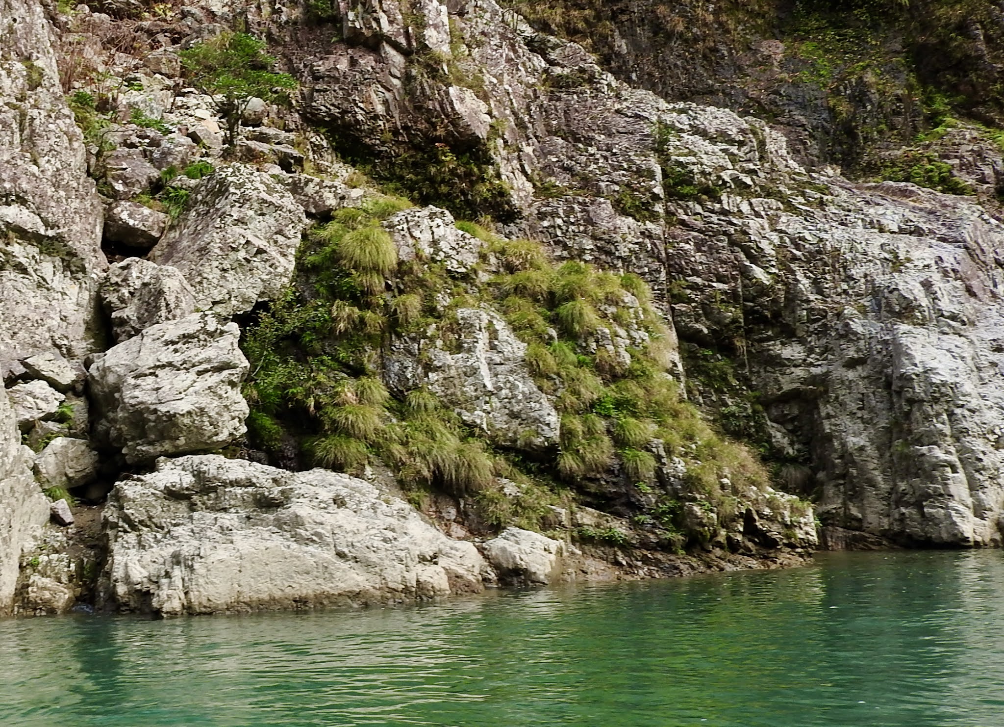 |
 |
こま犬岩紅白の首輪がつけられています。Komainu Rock A red and white collar is attached. According to Wiki about Komainu, "Komainu (狛犬), often called lion-dogs in English, are statue pairs of lion-like creatures either guarding the entrance or the honden, or inner shrine of many Japanese Shinto shrines or kept inside the inner shrine itself, where they are not visible to the public."  紅白の首輪がなければ、私は'こま犬'とは気がつかなかったでしょう。Without the red and white collar, I wouldn't have noticed a 'Komainu'.  |
 |
| 獅子岩 Lion Rock  咆哮 (ホウコウ) が聞こえそう... It is as though I can hear the roar.... 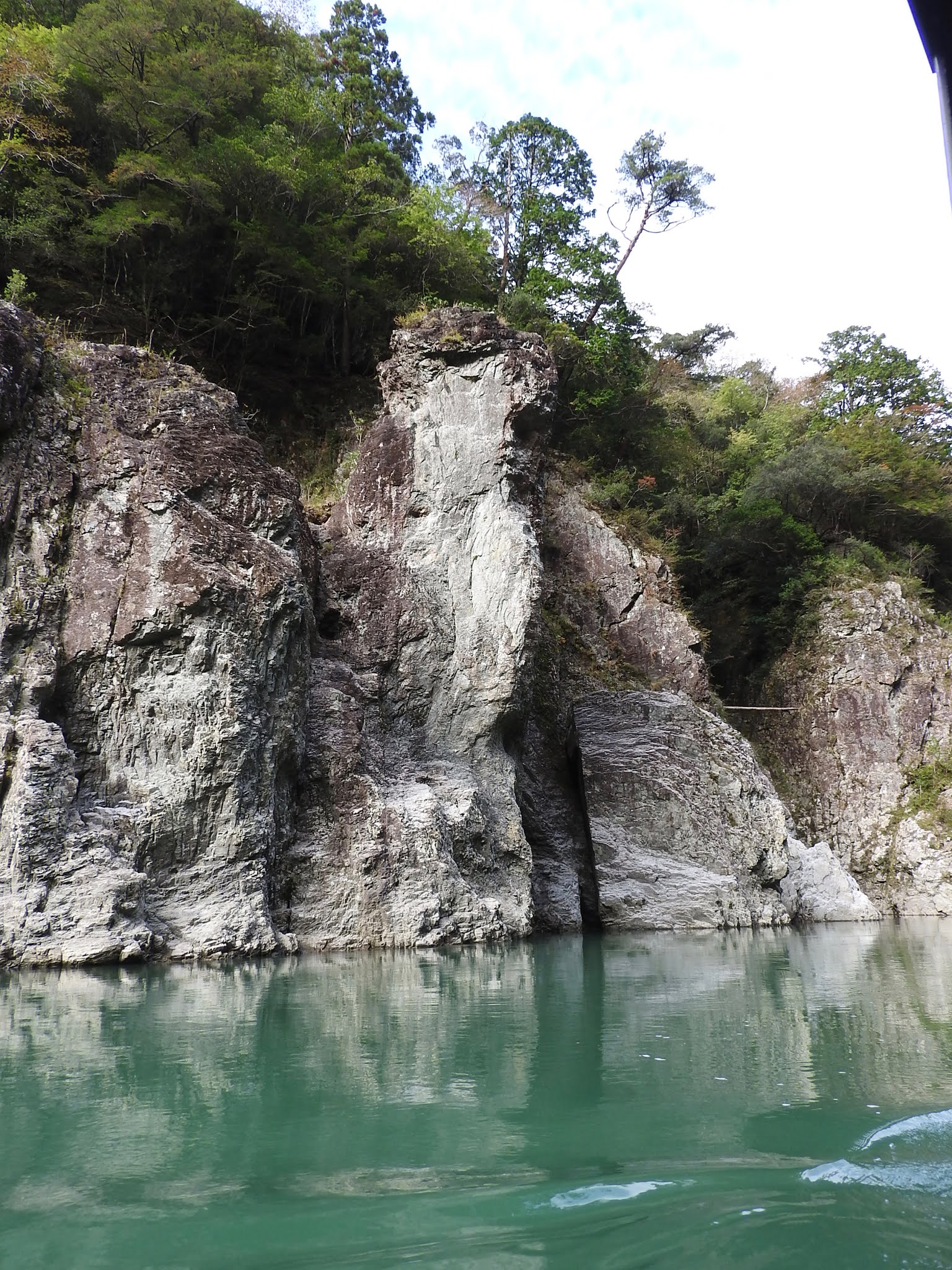 この角度からは、鷲か鷹のように見えます。 From this angle, it looks like an eagle or a hawk.  |


 |
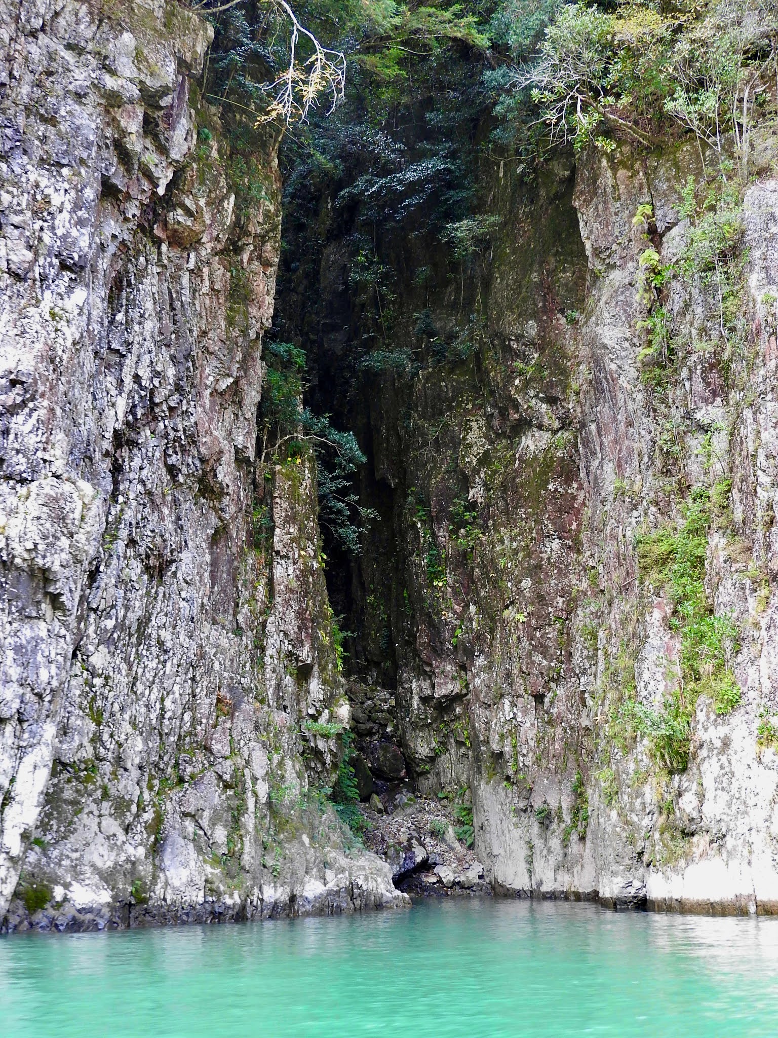
| 秘密の入り口 崖の割れ目を見るたびに、秘密の入り口か思い、 奥に唆 (ソソ)られます。 Secret Entrance Every time I saw a crack in a cliff, I thought it was a secret entrance, and I felt drawn towards there... |


 |
| 深い、深い色... Deep, deep colours ... |
6) 下船 / Disembark
 |
| 田戸係留所 通常のコースは、ここで休憩し、 "小川口係留所または志古乗船場"に戻りますが、私達は下船しました。 とても面白かった〜! 次回があるなら、和船に乗ってゆっくり舟下りがしたいです。 Tado Mooring The normal course takes a break here and returns to "Ogawaguchi Mooring or Shiko Boarding Point", but we disembarked. It was very interesting! If there is a next time, I would like to take a Japanese boat and slowly cruise downstream.  右下のテントはお土産やさん 人が登って行きます。 私達もあの道を登りました。 The tent on the lower right is a souvenir stall. People climb up. We also climbed that path. |
 |
| 彼らの後を追います。 Follow them. |
 |
| さよなら〜〜! 和船も係留しています。 Good Bye! Japanese boat is also moored.  楽しかったです! 素敵な景色をありがとう! It was fun! Thank you for the wonderful scenery! |
 |
| 紅葉とエメラルド Autumn Leaves and Emeralds |

 |
| この階段の後で、山彦橋に行く予定でしたが、 添乗員さんが道を間違えて行けませんでした。 駐車場に到着後、どうしても行きたい人だけ 少し戻って行かれたようです。 私は吊り橋は弱いのでバスで待機。 Rはお疲れで、やはり待機組。 We were planning to go to Yamabiko Bridge after these steps, but the tour operator couldn't find a way there. After arriving at a carpark, it seemed that only those who really wanted to go to the Bridge, went back a little and made it. I waited in our coach because I am weak for any suspension bridge. R was tired and waited, too. |
瀞峡、その言葉の響きとは違い、美しく、神秘的な場所でした。
It was a beautiful and mysterious place, unlike the sound of the words 'Dorokyo Gorge'.