
 |
熊野・南紀旅行 11月12 - 14日 Kumano and Nanki Trip 12 -14th of November Kii Peninsula Trip |
目次 / Contents
1) ツアー / Tour
2) 羽田空港から / From Haneda Airport
3) 日程 / Itinerary
1) ツアー / Tour
実際は、私達は前日から羽田空港近くのホテルに泊まったので、3泊
4日の旅となりました。
長い間、私は、熊野古道 (クマノコドウ) に行ってみたいと思っていました。
熊野古道には、以前から興味はありましたが、
『RDG レッドデータガール』[2008 - 2012 / 全6巻
を読んで、その興味は後押しされました。
熊野古道は、熊野三山 :
熊野本宮大社 (クマノホングウタイシャ)、
熊野那智大社 (クマノナチタイシャ)
熊野速玉大社 (クマノハヤタマタイシャ)、
へと通じる参道の総称です。
2004年に、
紀伊山地の霊場と参詣道 (キイサンチレイジョウトサンケイミチ)
の一部として、世界文化遺産に登録されました。
クラブツーリズム企画:

を見つけて、参加しました。
 |
| 赤い楕円線 : 紀伊半島 Red Oval Line : Kii Peninsula It is the largest peninsula of Japan. 画像は下記より/ This from ★ |
 |
| 紀伊半島 熊野古道の地図 (中世の巡礼路の地図) 画像は下記より / This from below |
 |
Kii Peninsula Map of Kumano Kodō : Map of the Old Roads of Kumano (Medieval pilgrimage routes) Red icons are shrines and a temple that the roads begin and terminate at. 画像は下記より / This from below |
Tour
I and my husband R had a two-night, three-day trip to Kumano Region and Nanki, from 12 - 14th of November.
Actually, we stayed in a hotel near Haneda Airport from the day before, so for us, it was a trip of 3 nights and 4 days.
The Kumano Kodō is a series of ancient pilgrimage routes that crisscross the Kii Peninsula.
I have been interested in Kumano Kodō, though a book
I read boosted that interest :
"RDG Red Data Girl" [2008 - 2012 / 6 volumes /
Written by Noriko Ogiwara (1959 ~) / Kadokawa Shoten].
Kumano Kodō are pilgrimage approaches to
"Kumano Sanzan" : 'Three Grand Shrines of Kumano', below,
(The group, Kumano Sanzan, is the head office of more than 3,000 Kumano shrines spread all over Japan.)
 |
| Red Circle ● : Sacred Sites and Pilgrimage Routes in the Kii Mountain Range 33°50′13″N 135°46′35″E 画像は下記より / This from below ★ |
Kumano Kodō is located on the Kii Peninsula and straddles Mie, Nara, Wakayama, and Osaka prefectures.
In 2004, it was registered as a World Cultural Heritage site as part of the Sacred Sites and Pilgrimage Routes in the Kii Mountain Range.
I found a tour by Club tourism :
"18 Views of Kii Peninsula ;
World Heritage Sites, Unexplored Areas and Superb Views
: Kumano Sanzan・Kumano Kodō ・Dorokyo Gorge・
Adventure World"
and we participated.
R was not interested in Kumano Kodō, and R who does not do research is not interested in travel destinations.
'Adventure World' is a simple place to enjoy and for R, it was like a "carrot".
 |
"RDG, レッドデータガール" 第1巻の表紙 "RDG, Red Data Girl" Cover of the first novel volume 画像は下記より / This from below |
2) 羽田空港から / From Haneda Airport
 |
| 富士山 ホテルから羽田空港に向かうシャトルバスの中から Mt. Fuji I photographed this in the shuttle bus from the hotel to Haneda Airport . |
 |
| 羽田空港 飛行機の中から撮影 左に富士山が見えます。 Haneda Airport Taken from inside the plane. I can see Mt. Fuji on the left. |
空から / From Sky
 |
| 神々の国 / Country of the Gods. |


 |
| 何層も重なった世界 A World with Many Layers |

 |
紀伊半島 / Kii Peninsula 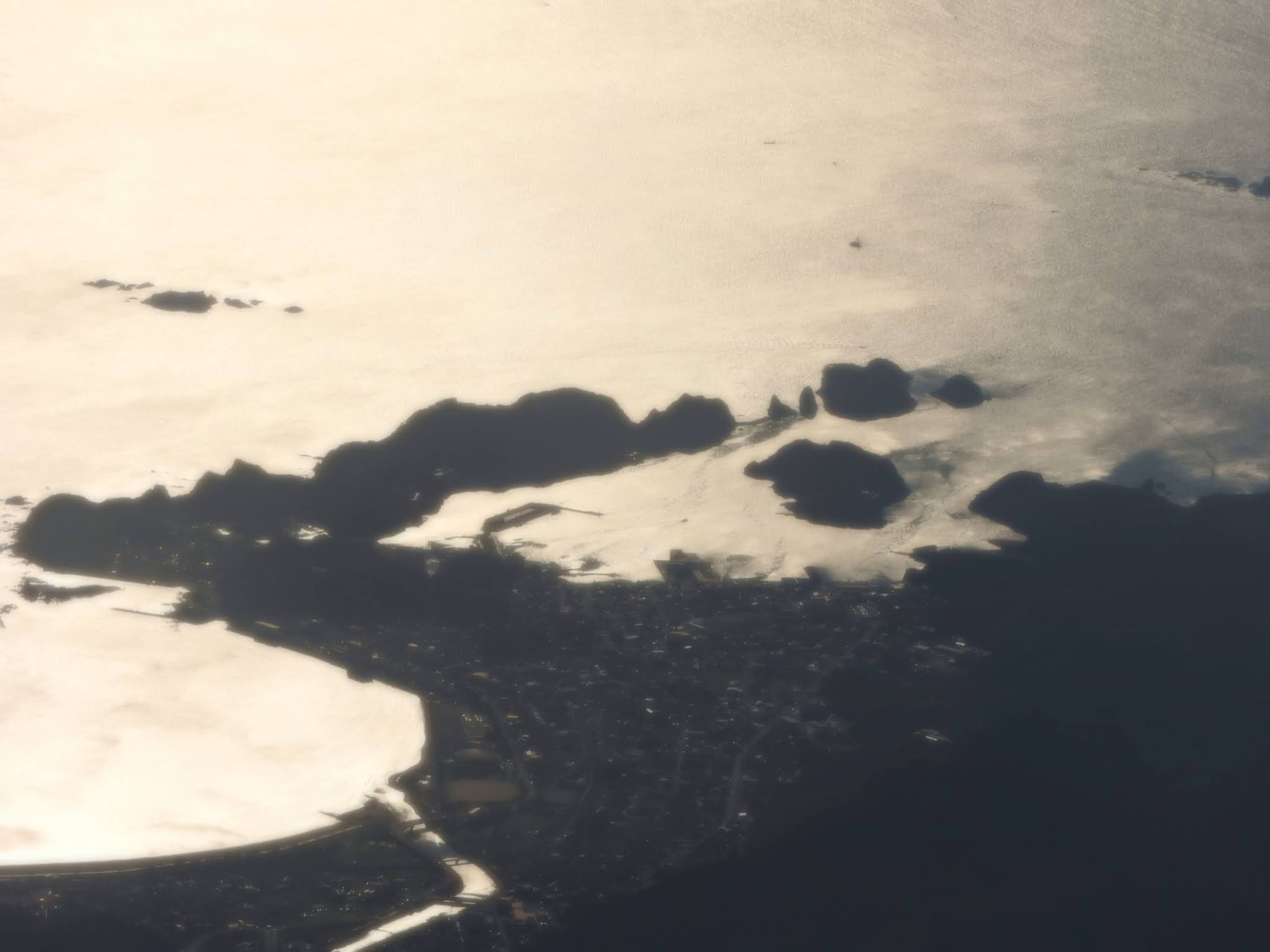 |


 |
| もうすぐ南紀白浜空港に到着します。 We will arrive at Nanki–Shirahama Airport soon.  |
3) 日程 / Itinerary
This was our tour's Itinerary, below.
Sorry, it is only in Japanese.


"Wakayama prefecture unites pilgrims, food lovers, and culture buffs in a tranquil corner of Japan at the base of
the Kii Peninsula.
The setting for many a Kumano Kodo pilgrimage trail, Wakayama invites those in search of spirituality from one side of the prefecture to the other, from the 100-plus Buddhist temples of the sacred Mount Koya in the west to the inspiring temples of the Kumano Sanzan set among breathtaking nature in the east."
0 件のコメント:
コメントを投稿