
 |
| 熊野・南紀旅行 11月12 - 14日 Kumano and Nanki Trip 12 -14th of November Kii Peninsula Trip |
目次 / Contents
1) 場所と空間 / Place and Space
2) 伝説 / Legend
3) マグマの塊 / Magma Mass
4) クリスタル・リバー / Crystal River
1) 場所と空間 / Place and Space
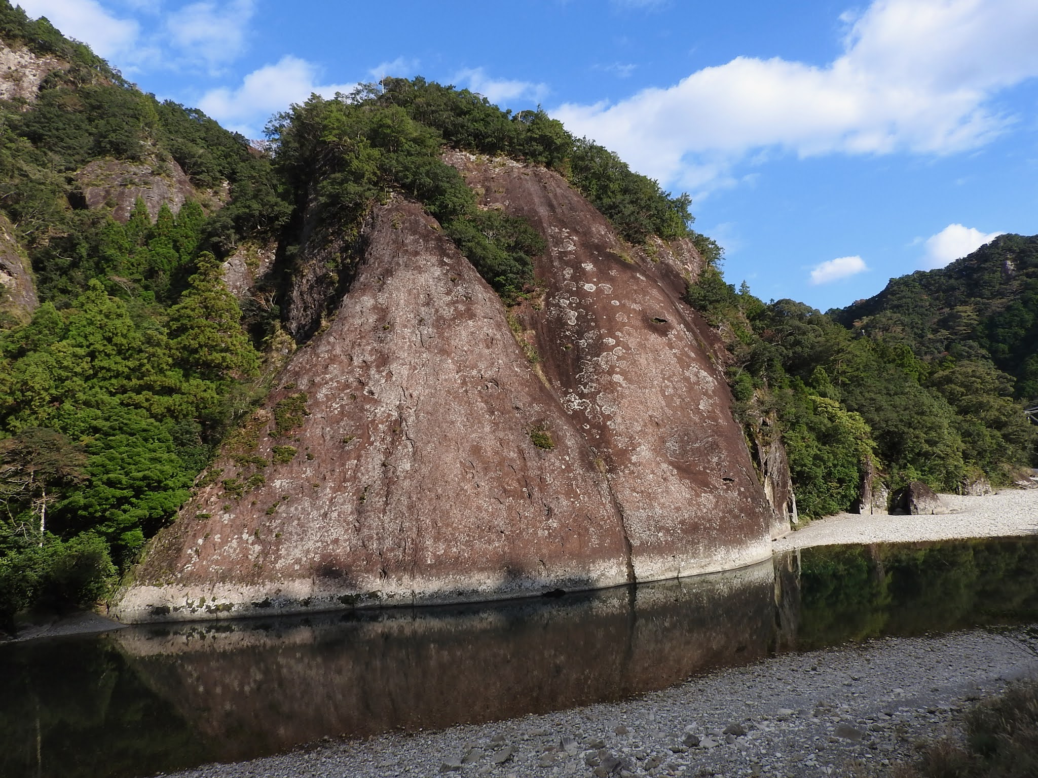
高さ約150m・幅約800mの一枚の巨岩です。
高さ約100m・幅約500mと言う表示もあります。
これは計測点の違いかな?と推測します。
 |
| バスから お〜っ!と素直にびっくり! 大きすぎて、岩として認知できないです〜! From Coach WoW! I was honestly surprised! It's too big to be recognized as a rock! |
Place and Space
The 'Koza-gawa River Monolith' : 'Ichimai-Ia Monolith' is a huge rock with a height of about 150m and a width of about 800m on the left bank of the Koza-gawa River
There are also indications that the height is about 100m and the width is about 500m.
I guess that there might be differences in measurement points.
 |
| 赤い部分 : 和歌山県 Red Part : Wakayama Prefecture 画像は下記より / This from below ★ |
| 和歌山県 黄土色部分:古座川町 Wakayama Prefecture Yellow Ochre Part : Kozagawa chō (Kozagawa Town) 画像は下記より/ This from below★ |
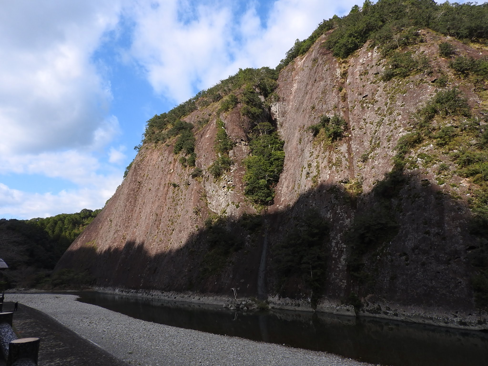 |
| '古座川の一枚岩' 国指定の天然記念物です。 '天まで覆う大屏風' と呼ばれます。 '大きな屏風' があるにもかかわらず、 開けた空間で気落ちが良い場所です。 'Koza-gawa River Monolith' This is a Nationally Designated Natural Monument. It is called 'Large Folding Screen Covering Sky'. Despite being the 'Large Folding Screen', here is an open space where I feel fairly comfortable.   ① 古座川の潜水橋 ② 獄ノ森山 ① Sensui-kyo Bridge over Koza-gawa River ② Mt. Dake-no-Moriyama |
 |
| Guide Map, Around 'Koza-gawa River Monolith' : 'Ichimai-Ia Monolith'  |
 |
| イラストレーション・マップ 地域に対する愛情が伝わってくるマップです。 Illustration Map only in Japanese It is a map that conveys her love for the area.  地図原画作成者・生駒 和歌子 Original map created by Wakako Ikoma |
地図が大好きな私は、地図を見つけると嬉しくなり、ブログにもみんな載せたくなってしまいます...。
自分がイラストレーターの時も、地図の仕事が多かったです....懐かしい....。
As a map lover, finding a map makes me happy and makes me want to post the map in my blog ...
Even when I was an illustrator, I had a lot of map work .... it reminds me of those happy times.
2) 伝説 / Legend
私は神話や伝説が好きなので、どのように岩ができたかと言うよりも先に伝説に目がゆきます。
I like myths and legends, so I look at legends before how rocks are made.
 |
案内板より/ From Guide Board in Japanese 下記、Wikiより "一枚岩のほぼ中央に縦に通る凹みは、 このときの魔物の歯型であると伝わり、 雨が降り続いた時に上の池から水が溢れでて 流れ出ると出現する「陰陽の滝」は、 魔物の悔し涙が流れ落ちたものであると伝えられる。" |
 |
| 案内板 Guide Board in Japanese and English |
Legend Summary; Monolith Guard Dog
"A long time ago, a monster who loves rocks went up the Koza-gawa River while devouring the rocks.
Finally, when a monolith was bitten by the monster, a hunting dog living in a village and drove away the monster.
Only the monolith remained.
The dent that runs vertically in the center of the monolith is said to be the tooth pattern of the monster at this time.
It is said that the "Yin-Yang Waterfall" that appears when water overflows from the upper pond when it continues to rain is the regretful tears of the monster."
According to Ana website,
"Legend has it that the monolith was once protected by a brave dog whose shadow appears on the rock's wall in late April and late August every year."
"Legend has it that the monolith was once protected by a brave dog whose shadow appears on the rock's wall in late April and late August every year."
 | ||
| "陰陽の滝" この日は良いお天気だったので、'魔物の悔し涙' は少ないです。 "Yin-Yang Waterfall" The weather was fine on this day, so there were few of 'the regretful tears of the monster'. |
3) マグマの塊 / Magma Mass
 |
| 案内板/ Guide Board in Japanese |
 |
| 案内板 Guide Board in Japanese and English   |

 |
| 火山から 凝灰岩 (ギョオウカイガン) でしょうか? 下記、凝灰岩について、Wikiより "凝灰岩は、火山から噴出された火山灰が 地上や水中に堆積してできた岩石。" From Volcano Is it Tuff? According to Wiki about Tuff, "Tuff is a type of rock made of volcanic ash ejected from a vent during a volcanic eruption." |
 岩の中に、穴が所々、見えます。 '伝説では穴だらけにならなかった' とありますが、少しは穴ができてます。 I can see some holes in the rock. 'Legendarily, it isn't full of holes', although there are some holes. |
 穴の中がどうなっているのか、 知りたくなります。 I want to know what's going on inside the holes.  |
4) クリスタル・リバー / Crystal River
大塔山は、田辺市と古座川町の境界にあり、標高1122mです。
[日置川 は、千丈山 (センジョウザン / 標高1027m)が水源と言う説もあります]
 |
| 古座川の旅 左上、大塔山から 右下の古座大橋(地図には '古座')まで Koza-gawa River's Journey only in Japanese From Mt. Otou on the upper left to Koza Ohashi : Koza Big Bridge on the lower right. 地図原画作成者・生駒 和歌子 Original map created by Wakako Ikoma |
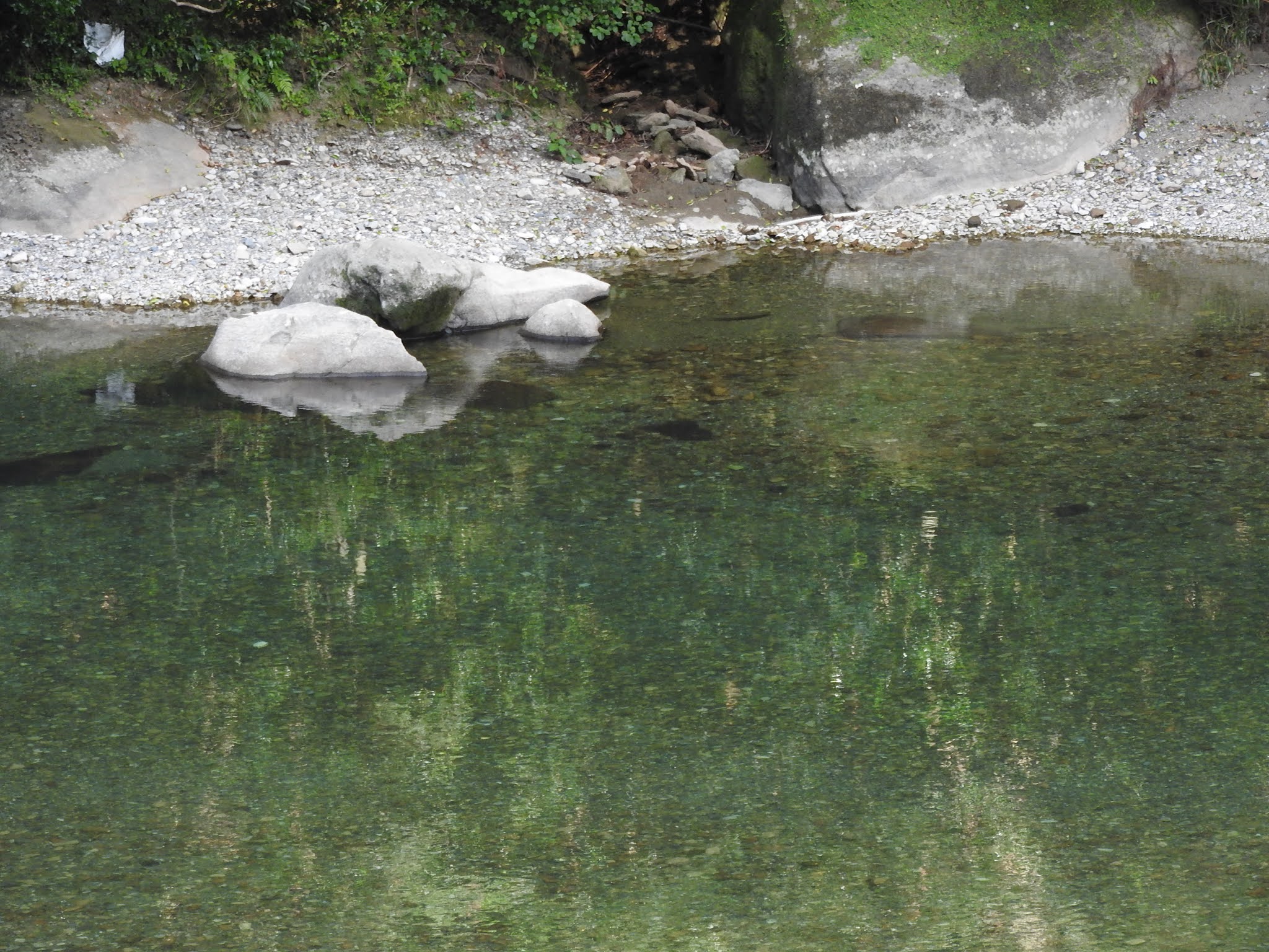
Crystal River
The Koza-gawa River flows out of Mt. Otou and pours into Kumano Sea over 60km, showing various characters.
The Kumano Sea is a body of water belonging to North Pacific Ocean located off the coast of Kumano Region of the Kii Peninsula.
Mt. Otou is located on the border between Tanabe City and Kozagawa chō, at an altitude of 1122 m.
It is the water source for the Kumano River system, Kozagawa River system, and Hiki River system.
[There is also a theory that the water source of the Hiki River is Mt. Senjozan (altitude 1027m)]
 |
| 古座川の川面 The surface of the Koza-gawa River |
 |
| 'クリスタル・リバー' 透明度が高く、'クリスタル・リバー' と呼ばれることに納得がゆきます。 'Crystal River' It's so transparent that it makes sense to call it 'Crystal River'. 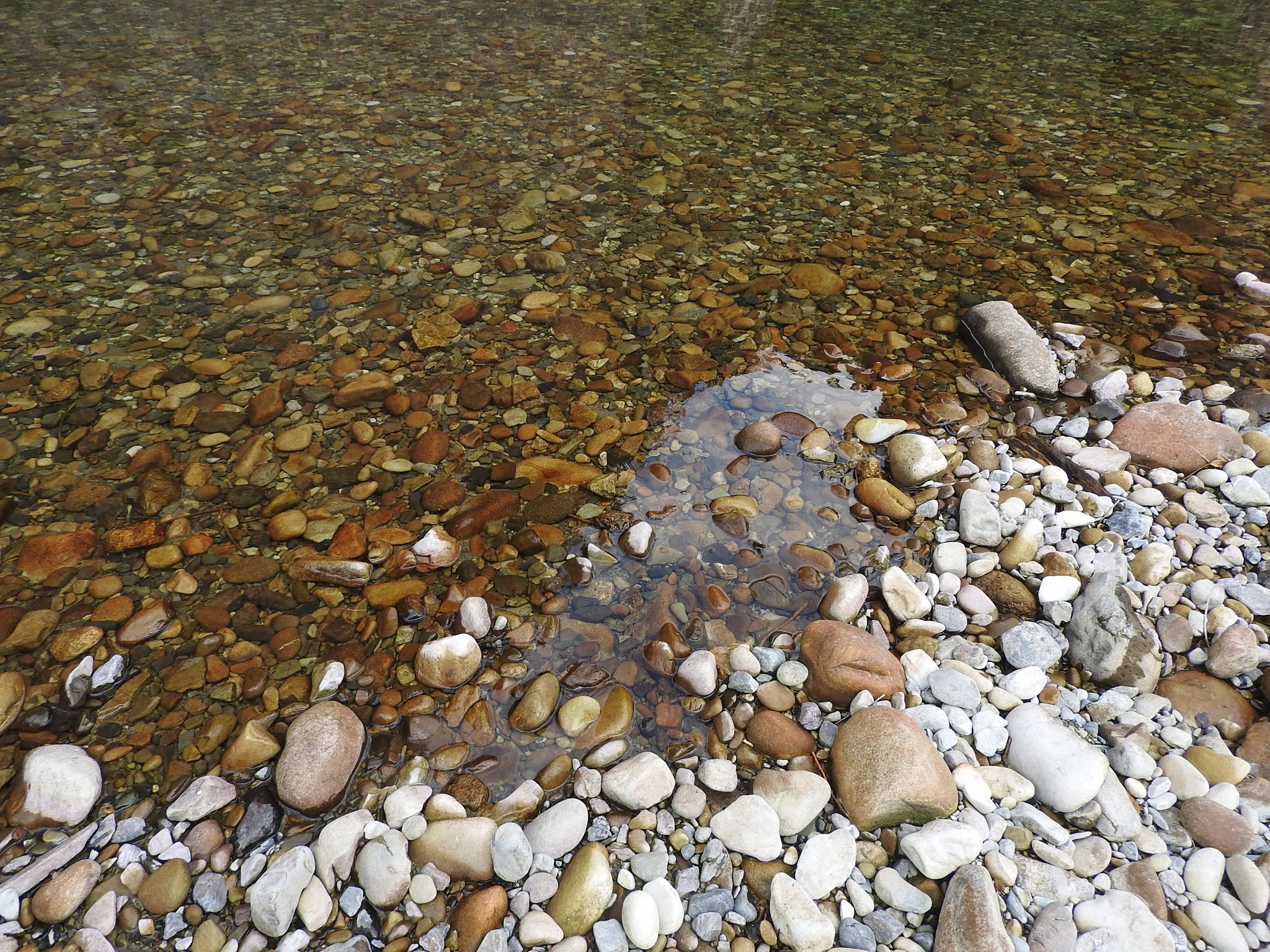 |


 |
| 本当に、水が綺麗でうっとりしてしまいます。 The water is really clean and fascinating. |
 |
| 口に見えます。 I can see it as a mouth. |
 |
| 鯨か、サメか? Whale or Shark? |
 |
| 金魚 古座川の水を使用して、 金魚が飼われているように思います。 Goldfish I think that goldfish are kept using the water of the Koza River. 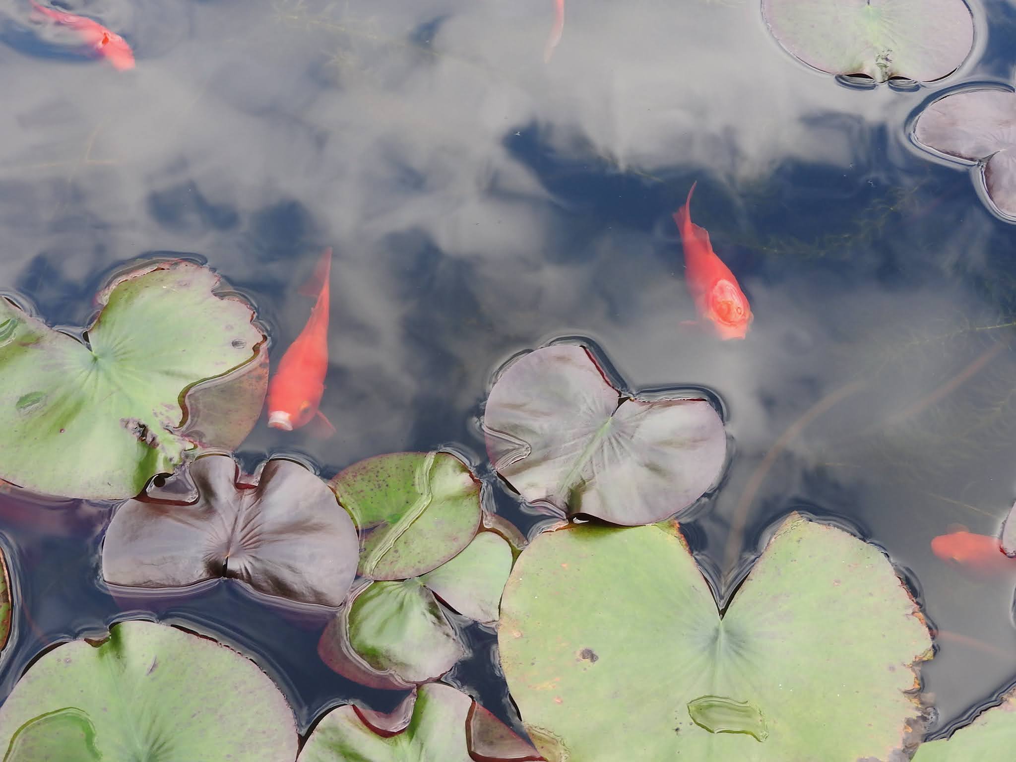 |
 |
| 道の駅・一枚岩 Roadside Station (Michi no eki) : 'Monolith' |
 |
| 獄ノ森山側 Mt. Dake-no-Moriyama Side |
車窓 / Coach Window
 |
| 古座川沿 Along Koza-gawa River  |
0 件のコメント:
コメントを投稿